
Geographic Information Systems essential for monitoring and recovery of Guatemala´s forests

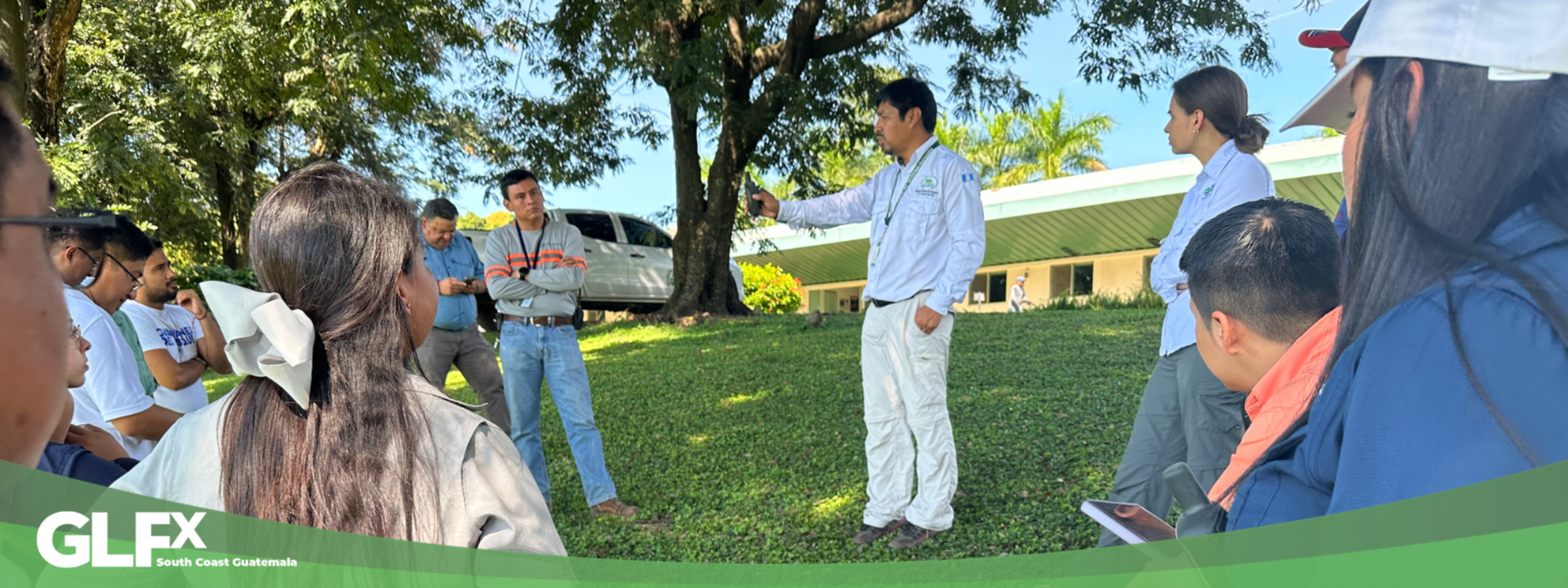
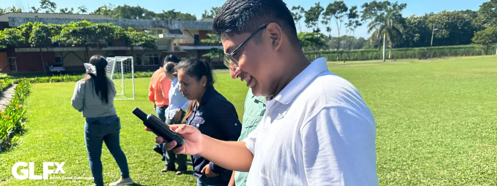
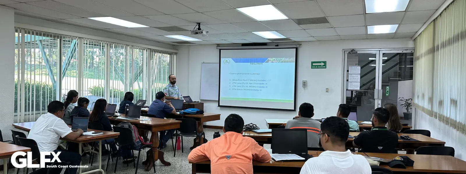
On November 28th the Restoration Network held a Geographic Information System workshop, providing monitoring and systematization tools to identify different forest landscape restoration and recovery areas.
"By developing this kids of skills it is much easier to be able to generate strategic infomation to demonstrate to work that each of the partners is doing in the field. This allows us to know how many areas are being recovered, which species and where they are located, and which actors are involved. The GIS helps us to have better control of the potential areas for forest recovery" César Zacarías INAB.
The workshop promoted by the GLFx South Coast Guatemala chapter and organized by the National Forest Institute (INAB), was attended by different institutions that are members of the Restoration Network such as: INAB, ICC, the National Council of Protected Areas (CONAP), Novaforest, Rainforest Alliance, Ministry of Environment of Guatemala, sugar industry and representatives of the municipality of Palín, who learned about conceptualization and use of geographic information systems, mapping, and territorial analysis.
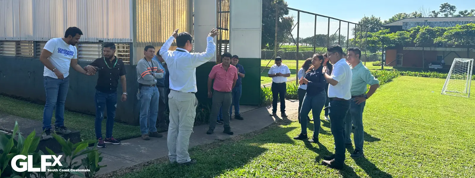
The workshop was developed in two phases: the theoretical phase was given by Engineer Bernardo Antonio Gordillo with theory and software installation, and the practical field phase was given by Cesar J. Zacarias, both from the National Forest Institute (INAB). In addition, during the training, participants were invited to create their account in the GLFx South Coast Guatemala chapter and showed interest in let know these actions so that the world knows the benefits of generating partnerships and capacity building for forest landscape restoration.

Red de Restauración de la Costa Sur de Guatemala promueve el fortalecimiento de capacidades en Sistema de Información Geográfica
El 28 de noviembre la Red de Restauración de Costa Sur de Guatemala compartió el taller de Sistemas de Información Geográfica (SIG) brindando herramientas para el monitoreo y sistematización de los diferentes procesos de recuperación de áreas, para la restauración forestal.
“Al tener las capacidades instaladas es mucho más fácil poder generar información estratégica para poder demostrar el trabajo que cada uno de los socios hace en campo, esto nos permite saber cuántas áreas se están recuperando, que especies, donde están ubicadas y que actores participan, esto nos ayuda a tener mejor control de las áreas vacías para la recuperación de los bosques” César Zacarías INAB.
En el taller promovido por el semillero GLFx South Coast Guatemala y organizado por el Instituto Nacional de Bosques (INAB), participaron integrantes de diferentes instituciones que son miembros de la Red de Restauración como: INAB, ICC, Consejo Nacional de Áreas Protegidas (CONAP), Novaforest, Rainforest Alliance, Ministerio de Ambiente de Guatemala, industria azucarera y representantes de la municipalidad de Palín, quienes, obtuvieron los conocimientos en conceptualización y empleo de los sistemas de información geográfica, elaboración de mapas y análisis territorial.
El taller se desarrolló en dos fases: la fase teórica impartida por el Ingeniero Bernardo Antonio Gordillo con la teoría e instalación de software y la fase práctica de campo, por el Ing. Cesar J. Zacarías delegados del Instituto nacional de Bosques (INAB). Además, durante la capacitación a los participantes se les invitó a crear su cuenta en el capítulo de GLFx South Coast Guatemala, quienes mostraron interés para que estas acciones sean divulgadas y así el mundo conozca los beneficios de generar alianzas y el fortalecimiento de capacidades para la restauración del paisaje forestal.